| People
having consulted this article: ARTivision is a Web's page of the association "ARTivities" To come into contact: fred.idylle@wanadoo.fr have profitable readings ! send to us yours comments. thank you in avance. |
|
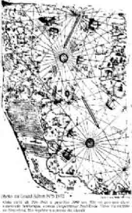
The Mystery of the Piri Reis' Maps I IntroductionThere exists by the World, a number astonishing ancient facts, wich in the current state of our knowledge , are not explained, as for example, cyclopean walls of Bimini, found in 1969> in theBahamas, the perfect granit spheres of 12 tons discovered in the forests of Costa Rica , the surprising outlines of the plain of Nazca in the Andes of Peru , which some of them are close to 15 km of long. But, (according to the 29 of August 1966, alas, of the vanished french review Planete the of Piri Reis' maps have however, so an high degree of strangeness, that they show off, presently the most disturbing question, on the vanished civilizations. II The genesis of the Piri Reis'maps affair . On the 9 November 1929, Mr Malil Edhem, Director of Turkish national museums by making an inventory of whole what contained the famous Topkapi's museum in Istanbul, discovers two maps of the world in a book entitled "The
Bahiyre" and whose the author was a certain admiral of the Turkish fleet "Piri Ibn Haji
Memmed", nammed henceforth, Piri Reis who were a famous hero of the XVI th century for Turkishs and a true pirate for the
others. He relates in this book, with full particulars, the conditions in which he realized the different maps (215 for the total) of his "Bahiyre". Piri Reis was a cultured man, remarkable man of sea who contributed to sit then the undisputed maritime supremacy of the Empire Ottoman. He elaborated thus two precious word-wide
maps, one in 1513 ,
To see the picture below:
and the other in 1528 (under the reign of Soliman the Magnificent). Piri Reis was a very meticulous scientist,and for example in the preface of his, Bahiyre, he evokes a long time, his first map drawn in his native city Gelibolu between March the 9 th and April the 7th of 1513 and he declares to have examined all existent maps known by himself some very secret and very ancient, (a twenty approximately), that him knowledge of Greek, Italian, Spanish and Portuguese, has grandly allowed to him to pull from it some profit. He also reveals, that he got in his possession, a map established by Christophe Colomb himself, and that he had obtained from a sailor of the Genoese, captured by Kemal Reis, his uncle. He asserts as well as, that Christophe Colomb, had only rediscovered America, and that he has had in his possession a book dating from the time of Alexandre the Great, revealing that at the end of the Western Sea (it is to day nammed the Atlantic Ocean), quite on the west, there were new coasts and islands covered of metals and precious stones and he asserts especially, that if Christophe Colomb offered to the natives of the first discovered island , glass jewellery that is because he knew well , according to this book , that these peoples was very fond of that. Here is already an extraordinary detail, that seems-it has never indeed still been publicly commented by specialists. And Piri Reis name, in addition with the well known Vikings , who approached America before Christophe Colomb, Sanvobrandant later becoming St Brandant, the Portuguese Nicola Giuvan and also Anton the Genoese etc.. Piri Reis¼maps discoveries, are on colored parchment , illuminated and enriched with many illustrations and painting portraits of sovereigns of many countries with turkishist legends. Turkishist specialists, nostalgic of the splendor period of Ottoman Empire looked into these maps with precaution and devotion without pulling consequenty, any notorious conclusions, but from them; they drew up reproductions, which were sent by the world, for requested libraries. .And then, it was in 1953, than an officer of the hydrographic US Navy Service , Captain Arlington H. Mallery, who leaned, for years, on the study of very ancient maps, by seeking to decode their system of projection, fell in ecstasy apon the copies of Piri Reis' maps that he had just been able to obtain. He had already indeed observed that a very ancient map ( the map of Zeno,1558), despite of its dissimilarities with modern maps, was based on realities, long forgotten, or even disparated, because this map shown, for example, that the earth of Greenland was divided (under the thick stratum of ice that covers it) in three parts, what had just discovered in 1951, a French expedition directed by Paul Emile Victor. Arlington Mallery had therefore immediately, the intuition that these maps of Piri Reis concealed as well a fascinating mystery. Helped by specialists in cartography as the Swedish Nordenskjold who took 18 years to establish the correspondence of the projecting system of the sea parchment (the portulans) with the one of the modern cartography , Mallery was convinced that the Piri Reis¼ maps shown , on the one hand, the oriental coasts of America, nevertheless well drawn with perfectly exact longitudes, while Christophe Colomb did not know to calculate them, but on the other hand, these maps shown also, truly , Antarctic and Greenland shores, but however, in the state where these shores appeared before the current pole glaciation. Indeed, according to modern techniques (gravimetry, seismic borings, etc...), realized by polar expeditions of various countries that have been able thus to probe under 3300 m of the ice of Antarctic and 4500 m of Greenland ås , conclusions of Mallery were formal: Greenland, such that it is drawn on the admiral Piri Reis¼ maps, corresponded to lines of relief found by these polar expeditions and especially to the two medians faults that divided this territory in three parts, what revealed already, we know it now , the map of Zeno.: Furthermore, in the Piri Reis'map of 1513, the shore that prolongs so lengthily the South America, could only be the Antarctic coasts which are, at the present time, more than three thousand meters under ice. Arlington Mallery took then care to follow the map, millimeter by millimeter and to establish each time the comparison with modern data. He then observed , for example, two bays noted on the Piri Reis¼maps at a certain place of Queen Maud Land of the Antarctic shore, while the recent map of the Antarctic established in 1954 by a certain Peterman shown only the firm earth. Mallery posed so well the problem to the American Hydrographic Service, that high level technicians, undertook seismic verifying borings to this place. And, what was a surprise for them?: The Piri Reis' maps got better of it . We are therefore now in front of an unavoidable dilemma, that is to say, either that documents (portulans) used by Piri Reis to establish the maps of 1513 and 1528 of his "Bahiyre", have been elaborate before the fifteenth century, by a unknown civilization, close enough to us, but capable also, as we, to probe under the polar ice, or , and that is still more extraordinary, that the exact data of these documents have been elaborate before the last ice age that has begun more than 10000 years. At this period reigned, according to the official science, the man Cro-Magnon's man who did not know, neither metals¼work, nor the earth¼s cultivation, neither even the domestication of animals and therefore he could not, in any way, realize cartographic researches so specialised and which necessitate, from one hand, explorers and technicians with particularly competence and high organization and especially from the other hand, in view of the immensity of the territory, modern means of locomotion going from cars to planes. III ConclusionCharles HAPGOOD, a geographer and geologist professor of the Keen State College the New Hampshire's University has re-examined, with his students, in detail, all this affair and has published in english 1966 on this subject, an imposing book , republished in french 1981 by Rocher's publisher and prefaced by Remy Chauvin and Paul Emile Victor and titled : " Maps of the ancient sea kings and subtitled: Evidences of the existence of a advanced civilization in the glacial period", very peculiar subtitle, which can only invite and question us on the fabulous past of our planet whose the richness , for a long time, will still surprise us.
Making out this article on the 1/09/98 and up dating it on the 17/04/2001. IDYLLE Fred |